Concon Master Plan
Location
Concon, Chile
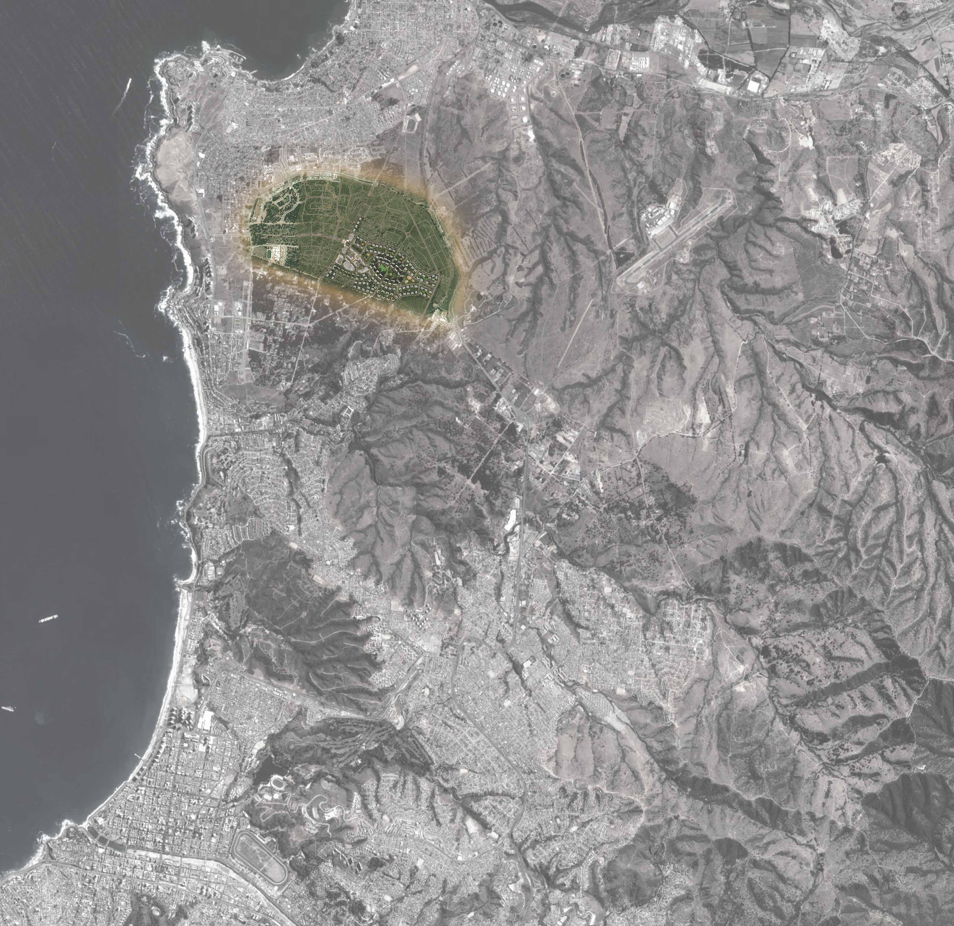
SCB planning was commissioned by a Chilean development firm to prepare a master plan and design guidelines for a 300 hectare (720 acres) located within the center of the peninsula and existing municipality of Concón, Chile. Based on research, site visits, and local knowledge provided by the client team, SCB established a community vision that ensures a highly livable, beautiful, and sustainable community.
This property is strategically located between two major regional highways, adjacent to the natural beauty of the rocky Concón Pacific coastline and dunes, and is near existing retail, commercial, and tourist destinations. Urban design of the master plan adheres to and enhances the current transportation and land use planning for the region and incorporates many recommendations including:
- Incorporating the new highway interchange to connect to I-5 International Highway and development of appropriate land uses and sustainable Greenway Buffer Zone.
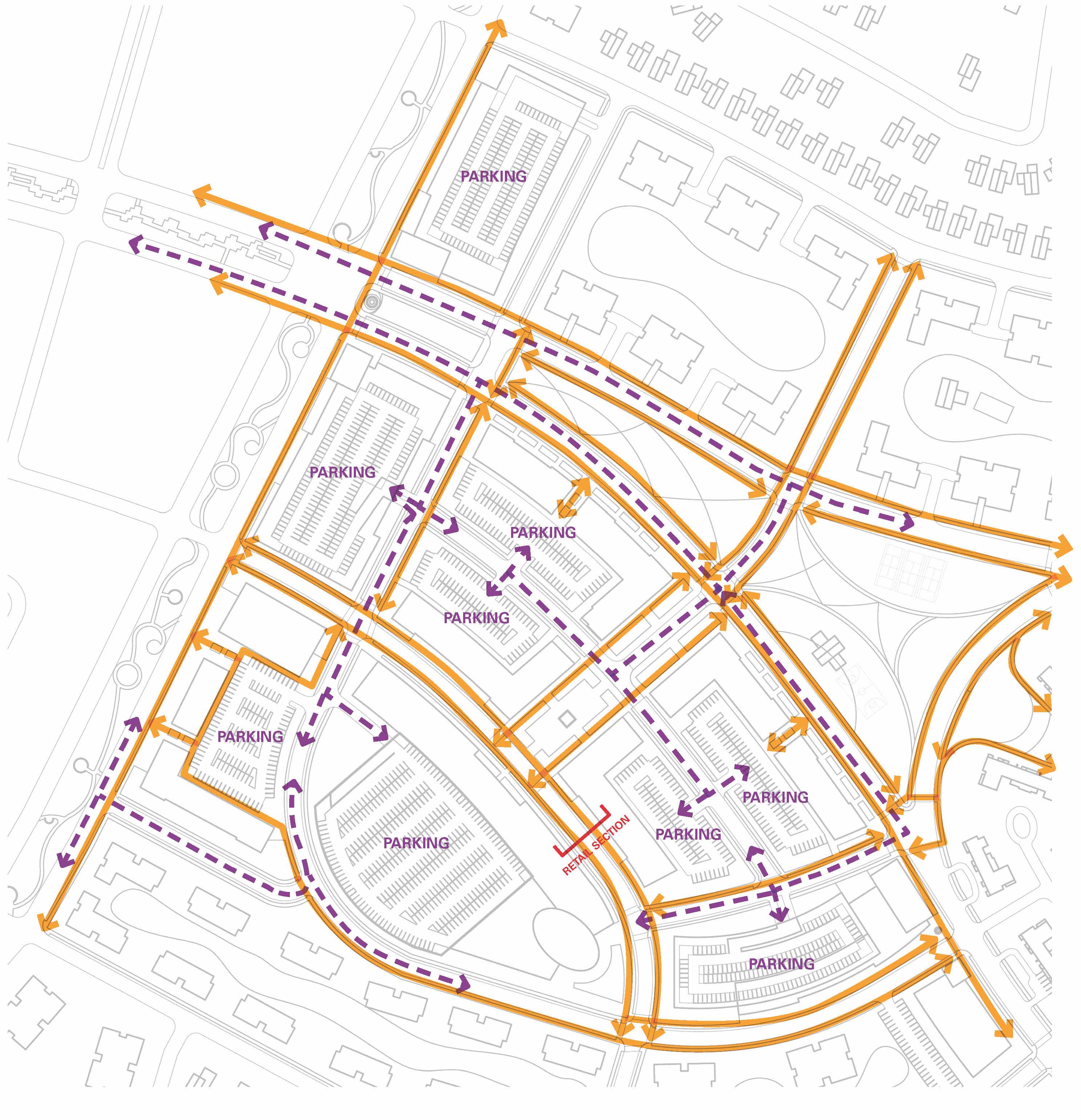
- Extending existing boulevards and avenues to establish an inter-connected parkway network with access to community facilities, parks, bikeways, and pedestrian paths.
- Establishing a diverse mix of housing types, densities, and price-points to match the current market expectations.
- Creating new residential zones to establish a greater sense of community, site security, and livability.
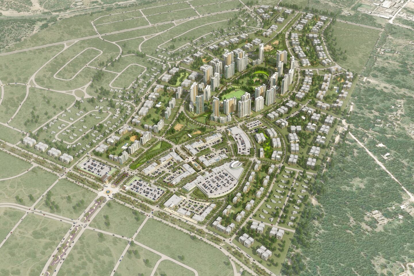
In additional to these considerations, the master plan strives to create vibrant residential neighborhoods surrounding a walkable mixed-use Town Center that will attract visitors both locally and regionally. These new neighborhoods will foster a high quality of life for residents by providing abundant amenities, a variety of housing choices, and opportunities for leisure and recreation.
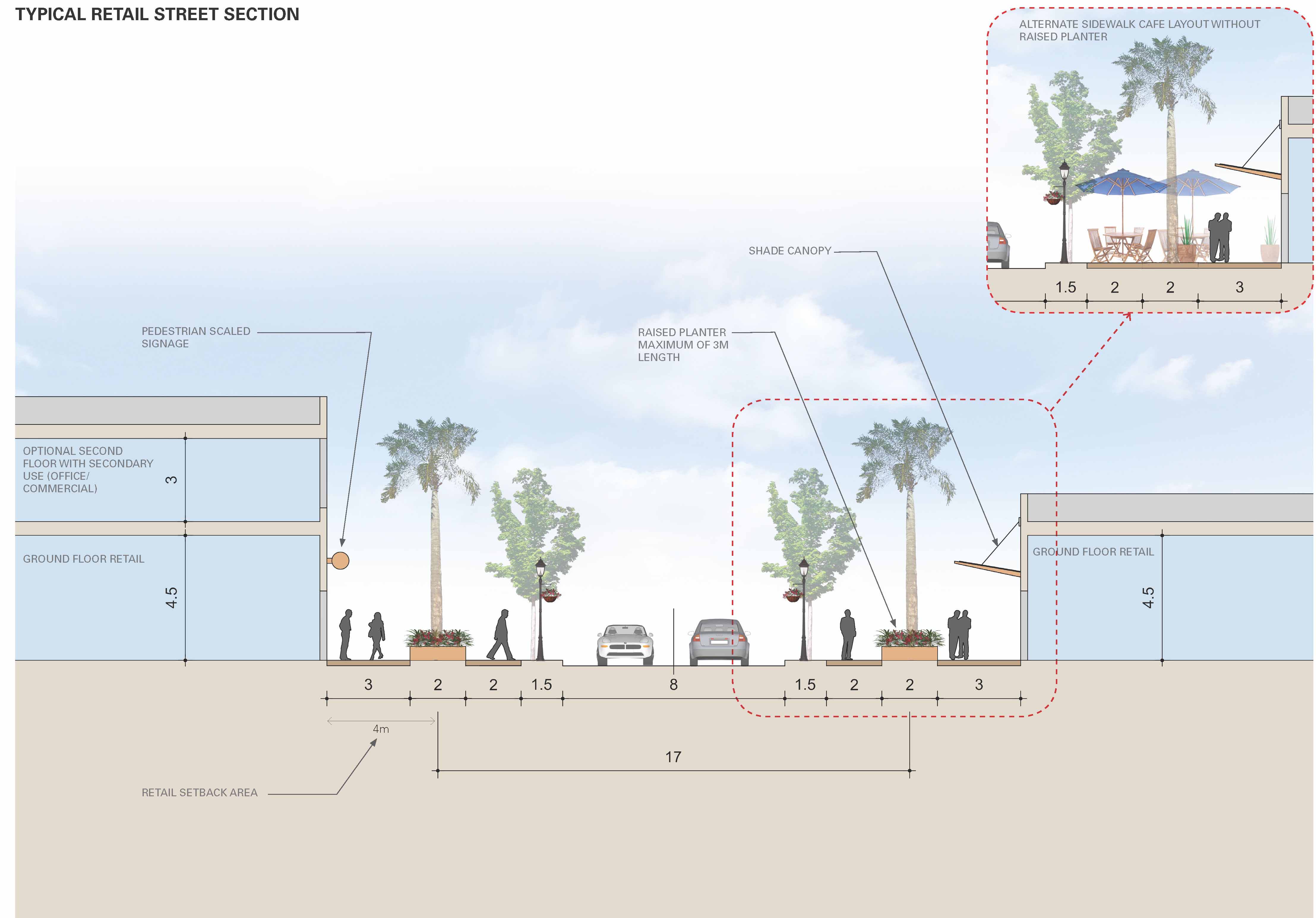
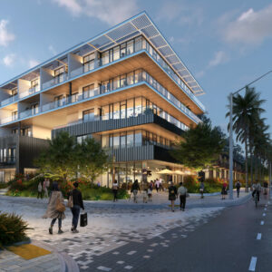
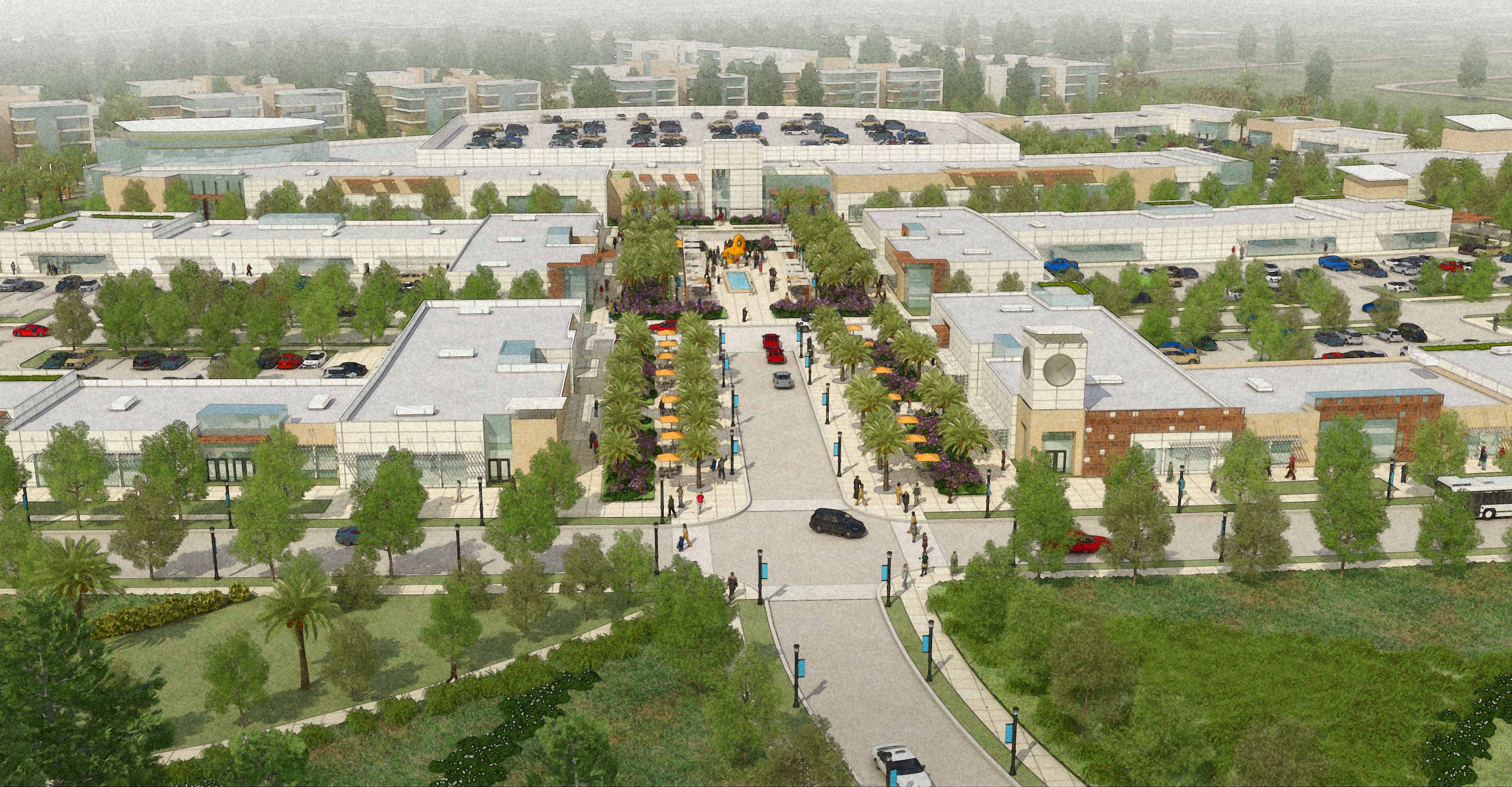
The Town Center District is strategically located at the intersection of the primary boulevards, which provides direct connections to the I-5 International Highway to the east and the coastal road to the west. The District is envisioned with a mix of various scales of retail ranging from large anchor departments stores to small storefront shops, services, and second floor offices. An inviting landscaped plaza is designed as a civic gathering place in the Town Center that will provide spaces for outdoor cafes, community events, socializing, and entertainment. The Town Center is designed to be a walkable district to reduce the negative impacts of vehicular traffic. The plan offers a hierarchy of pedestrian-friendly streets, locations for shared parking, and clearly demarked service access.
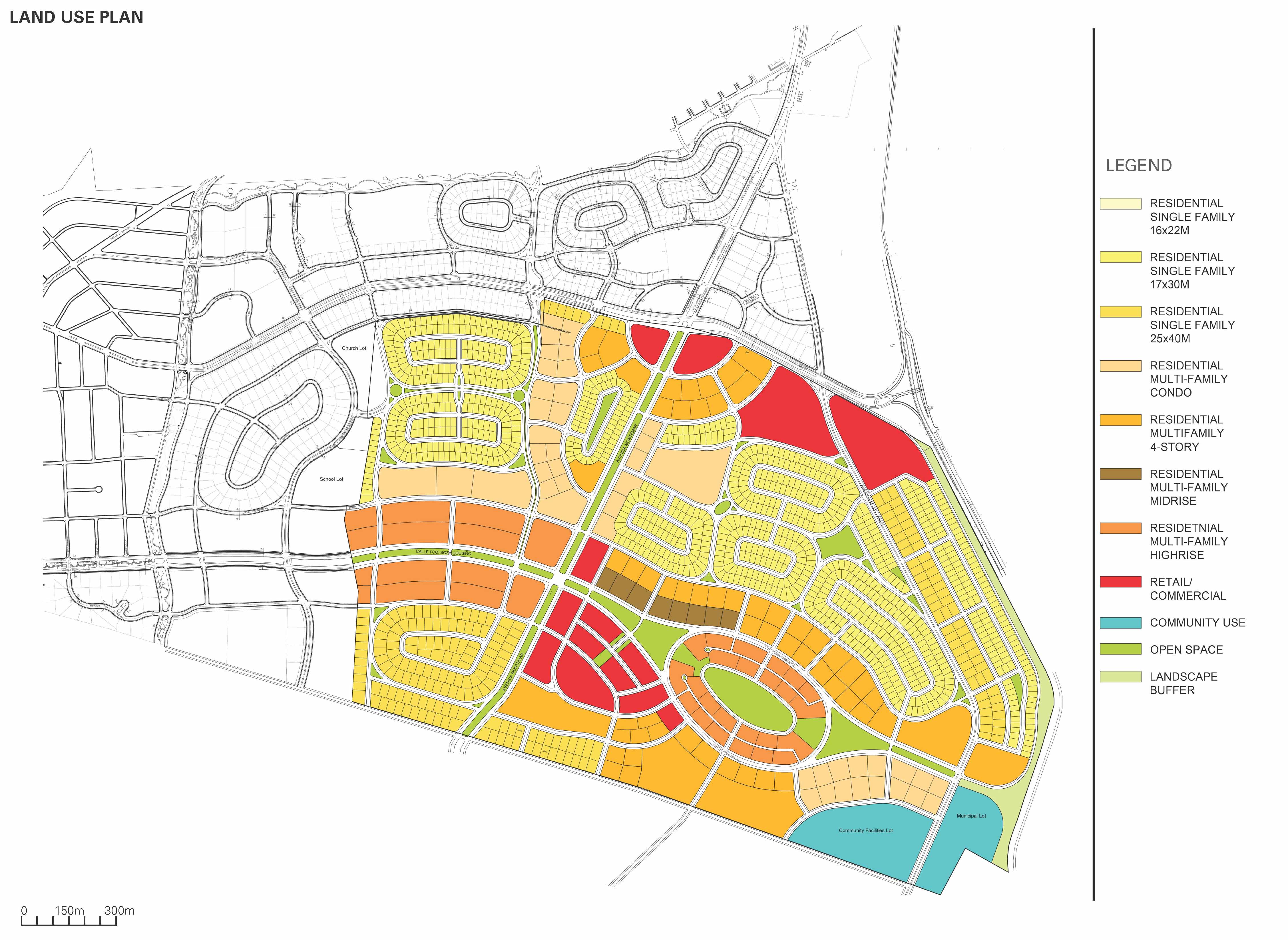
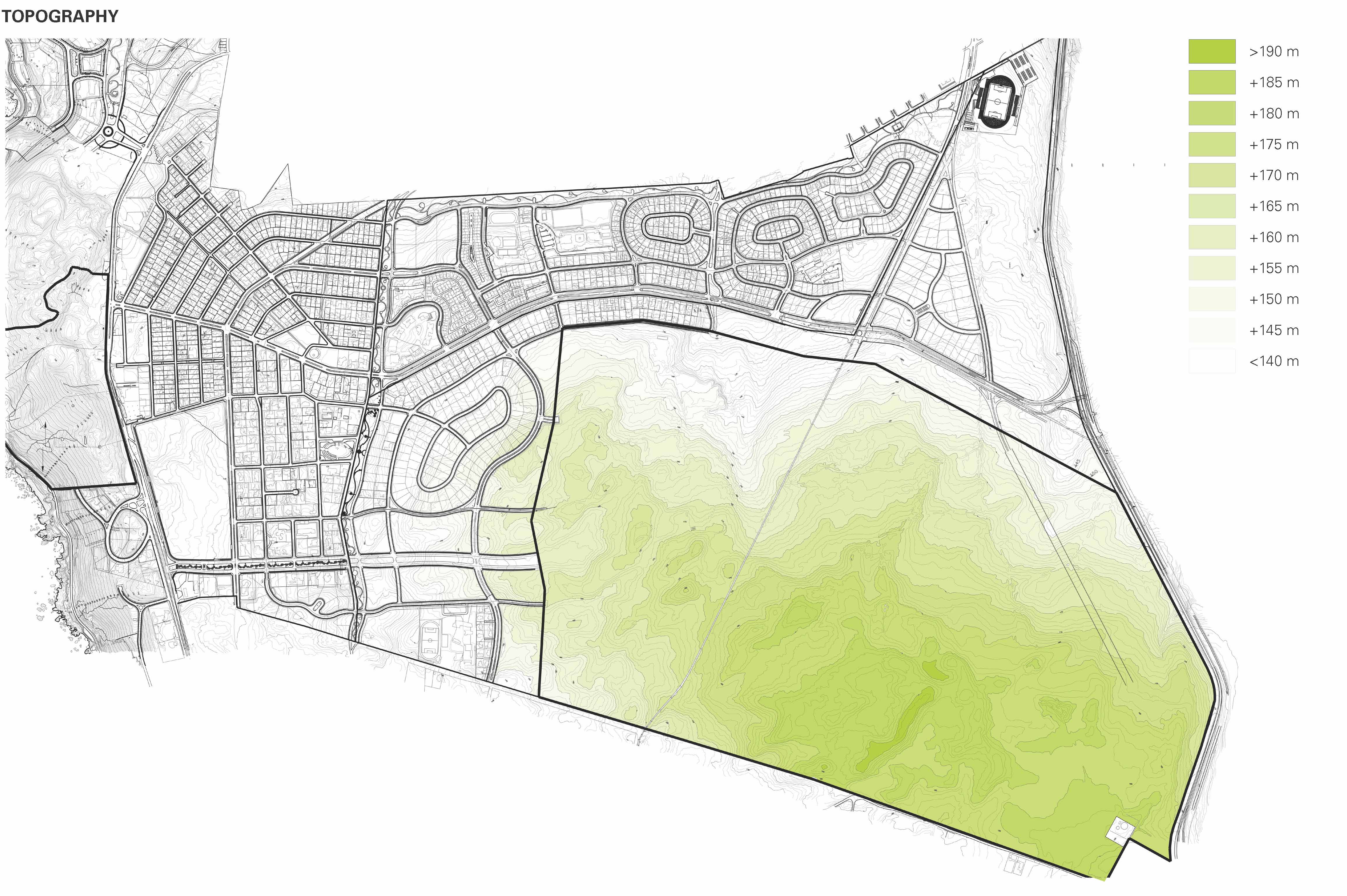
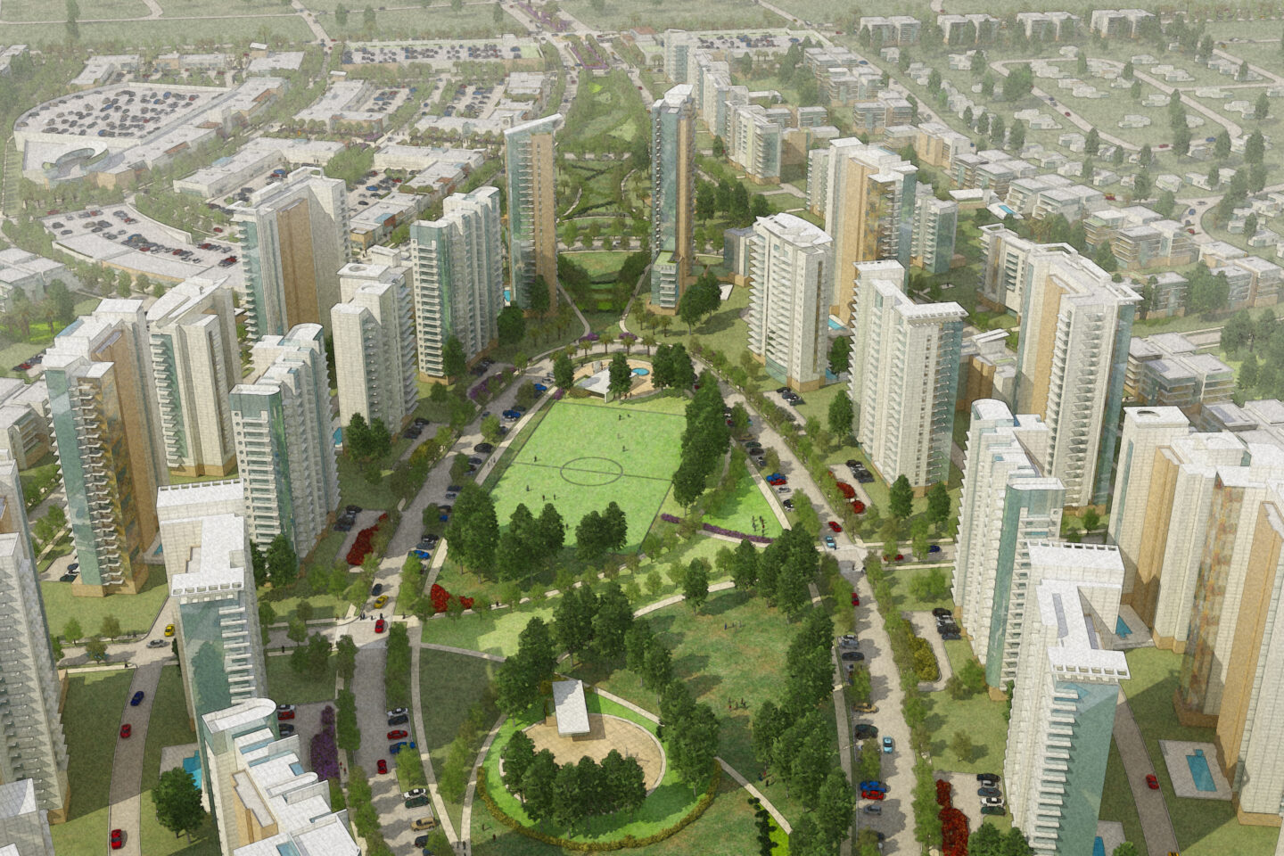
The High-Rise District was located on a plateau at the highest elevation to provide future residents with optimal views of the picturesque coastline, dunes, and mountains. The roadway network and parcel configurations not only take advantage of the natural terrain for ensuring spectacular views, but also incorporate a natural, gravity-fed storm water drainage system into the land plan. The towers are staggered both in plan and section to allow for better views out of the apartment buildings. The center of the District, the highest elevation point of the site, is reserved for a generous oval-shaped recreational park with sports fields, a community center, event space, and generous lawns for leisure activities.
The District is designed to allow for resident privacy/security and a relative openness, provided by the pedestrian paths at the east and west ends of the oval. These linear parkways provide continuous pedestrian circulation through the park and along the major boulevard. Additional public parks, located just outside the east and west ends of the District boundary, will act as transitions to the surrounding lower density residential blocks.