Urban Design & Visualization Services
Add To Collection
Client
Chicago Metropolitan Agency for Planning
Location
Chicago, IL
SCB Planning was contracted by the Chicago Metropolitan Agency for Planning (CMAP) to provide urban design concepts and high quality visualizations to support their Local Technical Assistance (LTA) projects. The LTA program was initiated by CMAP in March of 2011 with support from a US Department of Housing and Urban Development (HUD) grant to provide assistance to communities in implementing the GO TO 2040 Regional Plan.
Add To Collection
SCB’s urban design and visualization efforts have included the following communities and projects:
- Fairmont Town Center, Fairmont, IL – Redevelopment concept for a neighborhood town center to balance unique rural character with community development goals and pedestrian improvements.
- Blue Island Western Ave Corridor, Blue Island, IL – Retail corridor revitalization including streetscape, pedestrian safety elements, parking, and façade improvements.
- Norridge Town Center, Norridge, IL – Concept plan options for an under-utilized industrial site and vacant retail properties to be redeveloped into a new town center.
- Joliet Prison Redevelopment Vision, Joliet, IL – Imagery to illustrate the project vision and gather support for the redevelopment of the former Joliet Prison site.
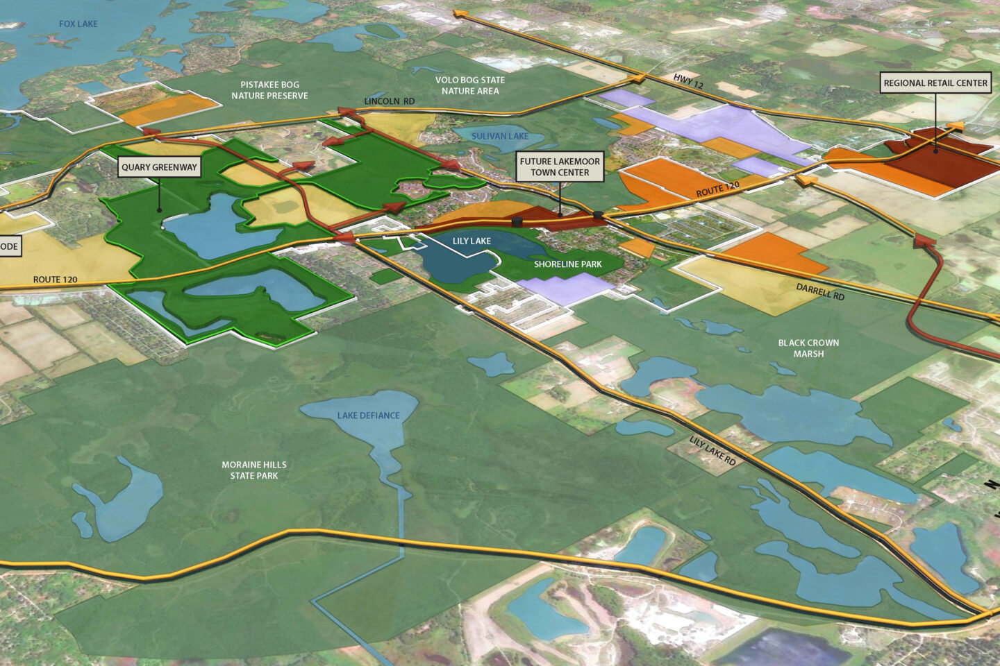
- Lakemoor Town Center, Lakemoor, IL – Urban design concept for corridor improvements to establish a town center, increase retail opportunities and provide greater access to a recreational lakefront.
- Irving Park Road Corridor Redevelopment Vision, Hanover Park, IL – Visualization of four revitalized sub-districts along the Irving Park Road corridor focusing on better access, streetscape, retail improvements, and site redevelopment.
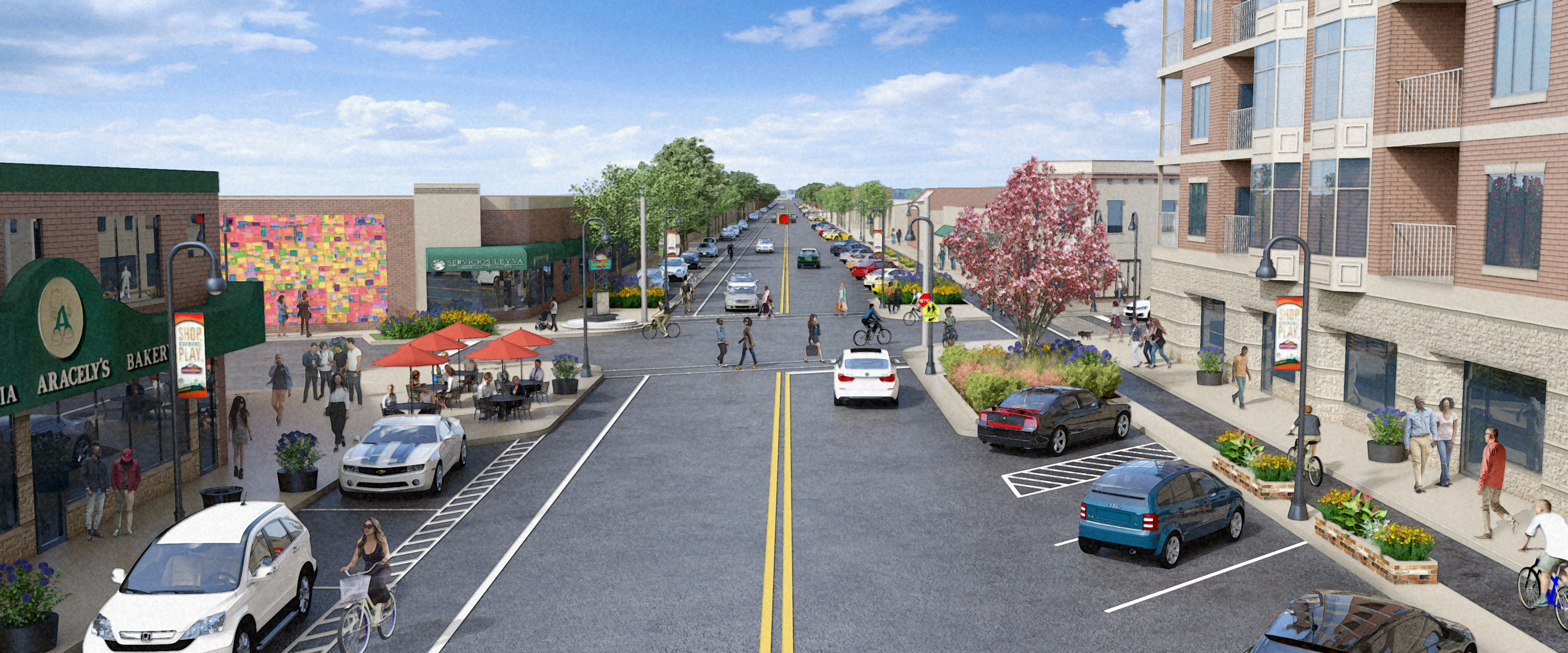
- Washington Street Retail and Trail Improvements, Waukegan, IL – Urban design concepts for the revitalization of a downtown Latino retail corridor and bike trail entrance, including ideas for improved signage, façade renovations, and streetscape.
- Metra Station Corridor Vision, Elmwood Park, IL – Redevelopment concepts for the district surrounding an existing Metra station to help improve access; increase walkability; and encourage higher density, transit-oriented development.
- Redevelopment Site Concepts, Chicago Heights, IL – Site design concepts for the redevelopment of a vacant site into a new industrial park, and the visualization of a concept for a new mixed-use development downtown.
- Metra Station Corridor Vision, Elmwood Park, IL – Redevelopment concepts for the district surrounding an existing Metra station to help improve access; increase walkability; and encourage higher density, transit-oriented development.
- Chicago Green Healthy Neighborhoods, Chicago, IL – Context diagrams, planning visuals and an illustrative overview to help promote the City of Chicago’s vision for this Near South Side Chicago district.
- Downtown Riverwalk Concept, Wilmington, IL – Concept for improving connectivity and attractiveness of Wilmington’s historic downtown retail corridor by converting a former parking area into a civic plaza, and improving the river’s edge with a pedestrian path, cafes, seating areas, and landscaped zones.
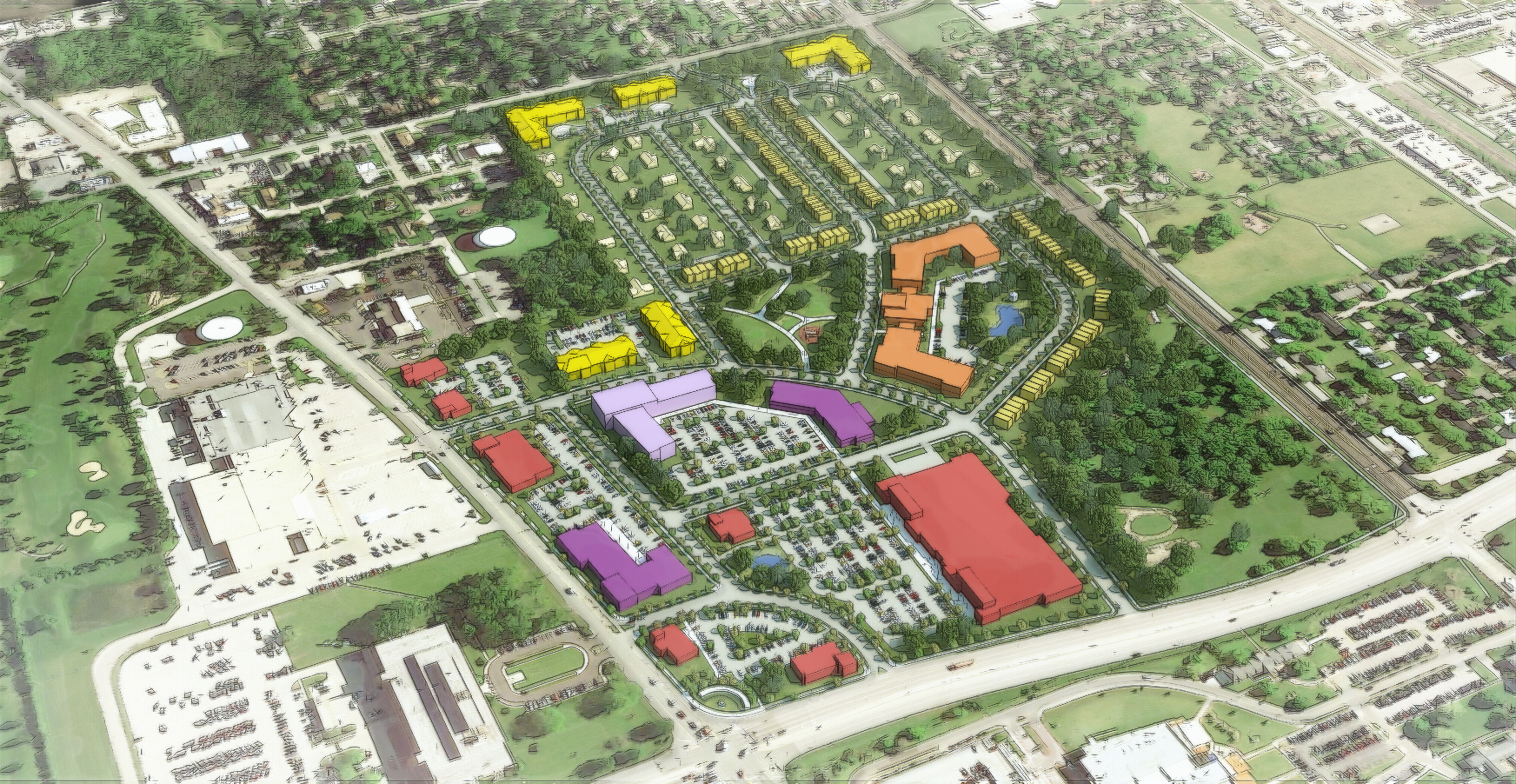
- Redevelopment Site Concept for Densification, North Chicago, IL – Concept master plan for the redevelopment of an underutilized suburban site into a denser, mixed use, more livable neighborhood.
- Gateway Development Concept, Carol Stream, IL – Concept for the development of underutilized sites along primary arterials roadways, and municipal gateways in Carol Stream.
- Conservation Subdivision Design, Sugar Run Creek, IL – Site plan study for expanded housing options in the community, on vacant land. Strategy included new multi-use trail connections and opportunities for a broader mix of housing types and densities.
- Bike Trail Concepts, Franklin Park, IL – Streetscape realignment concepts that illustrate how bike trails, shared lanes, and protected lanes could be added existing streets in the community to create a safer environment for alternative transportation.